Data Acquisition & Preparation
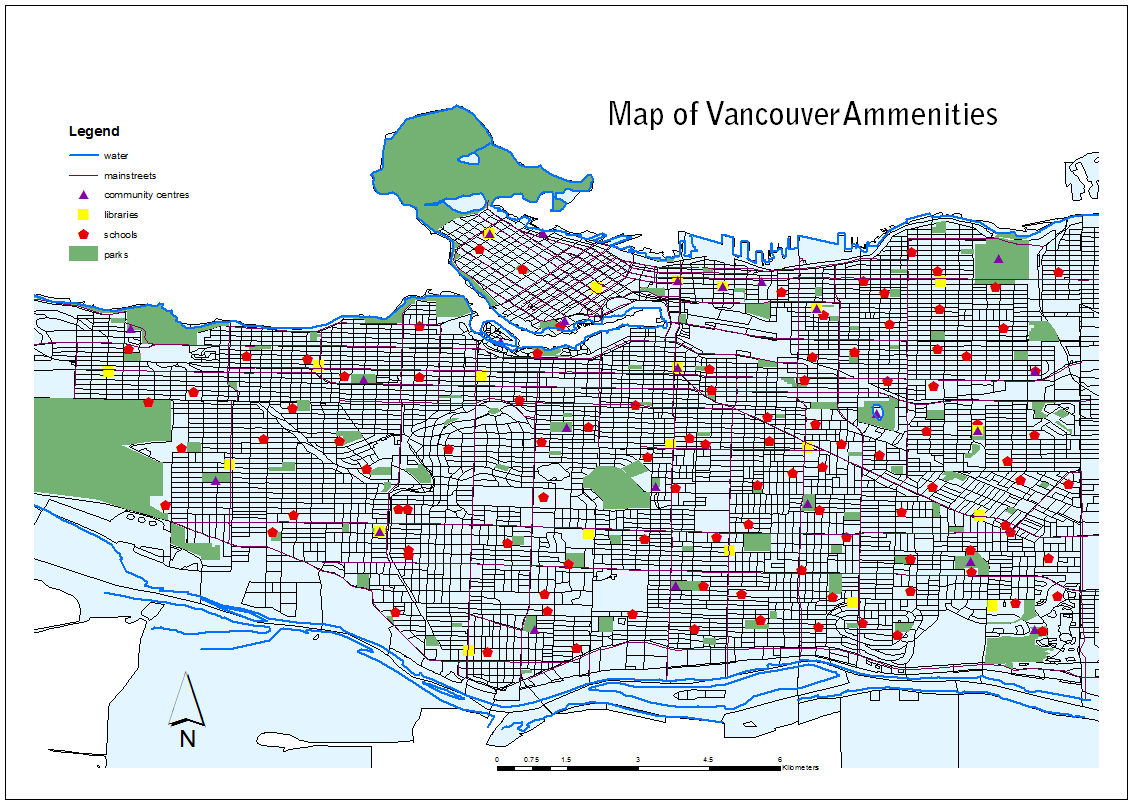
Data Preparation
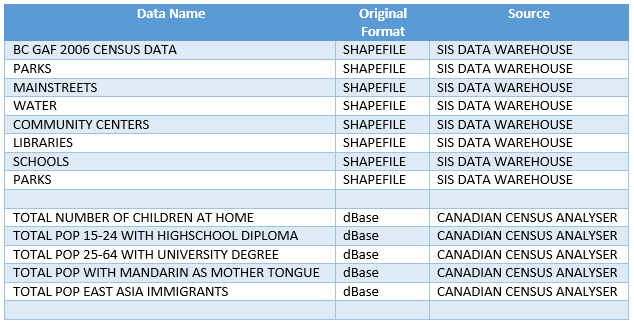
All of the shapefile datum from the Data Warehouse were converted into raster files and then converted again into ASCII text files in order to be imported into IDRISI.
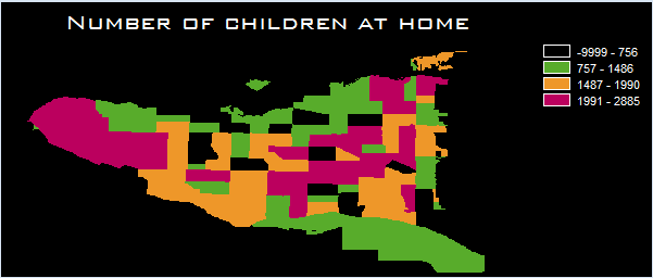
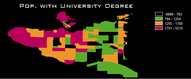
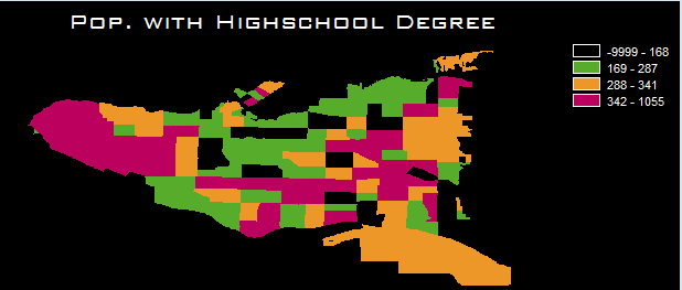
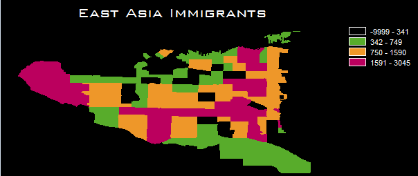
The BC GAF 2006 Census file was for the entire province of British Columbia. This data was clipped in ArcMap using the Select Features Tool and then Exported and Saved as a new Shapefile.
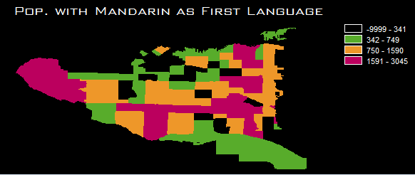
The rest of the attributes for my evaluation were dBase files retrieved from the Canadian Census Analyser. These files were then joined with the BC Census shapefile through the CTUID field.
For each census attribute, I created a separate BC Census shapefile layer to which it was joined. Each shapefile was then converted to a raster, which was then converted into an ASCII text file.
These ASCII text files were then imported into IDRISI Selva and converted into IDRISI raster files. UTM 49N projection was the selected reference system for these files.